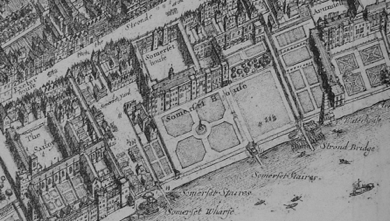
I try and bring along a range of very large maps showing London in the 1550s, the 1650s and 1660s [ie.just before and just after the Great Fire] the mid-18thc, the early 19th c and the early 20thc. I talk about the maps, how and why they were made, and what they show…and of course particularly about what they can tell us about gardens and gardening at the time. Everyone then gets a chance to have a good look for themselves.
Its a good opportunity to look at early maps of London [of course they mainly cover what are now the very inner boroughs] and to trace places you know through the ages. Its also great fun to see people crawling all over the floor although it does need a lot of space as the maps range in size up to about 3 metres across!
I am, of course, happy to just talk about any one map or group of the maps, or to talk about other things shown in them apart from gardens.


